NOTICE AND DESCRIPTION OF SHELLFISH AREA CONDEMNATION
NUMBER 096-230, HOG ISLAND – HODGES NARROWS
EFFECTIVE 15 JUNE 2026
Pursuant to Title 28.2, Chapter 8, §§ 28.2-803 through 28.2-808, § 32.1-20, and § 2.2-4002, B.16 of the Code of Virginia:
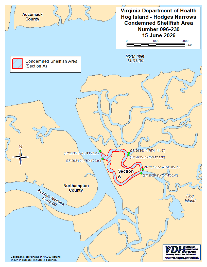
1. Condemned Shellfish Area Number 096-230, shown as Section A, is hereby established effective 15 June 2026, and shall remain in force annually thereafter until rescinded. It shall be unlawful for any person, firm, or corporation to take shellfish from this area during such period for any purpose, except by permit granted by Marine Resources Commission, as provided in § 28.2-810 of the Code of Virginia. The boundaries of this area are shown on the map titled “Hog Island – Hodges Narrows, Condemned Shellfish Area Number 096-230, 15 June 2026” which is part of this notice.
2. The Department of Health will receive, consider and respond to petitions by any interested person at any time with respect to reconsideration or revision of this order.
BOUNDARIES OF CONDEMNED AREA NUMBER 096-230
A. The condemned area shall include that portion of the unnamed tributary of Hodges Narrows upstream of a line drawn between latitude / longitude map coordinate (37°26'36.5",-75°41'23.9") and map coordinate (37°26'34.0",-75°41'22.9"); as well as downstream of a second line drawn between map coordinate (37°26'36.1",-75°41'11.9") and map coordinate (37°26'35.3",-75°41'11.9"); and downstream of a third line drawn between map coordinate (37°26'30.5",-75°41'05.8") and map coordinate (37°26'29.2",-75°41'06.4").