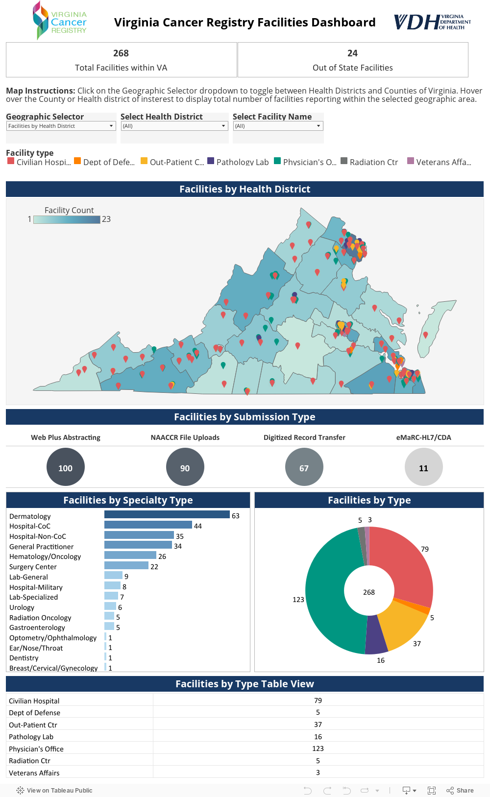
Navigation Instructions
- Click on the health district or county on the map to filter the other graphs on the dashboard to show related information.
- Each pin on the map is plotted to the address of the Facility. Hover over the pins on the map to view the Name, Address and Zip Code of the facility along with information related to facility type and specialty type.
- Each facility type is represented by a color. Click on the facility type color legend to highlight the facilities that belong to the
selected facility type. - Clicking on the data points on the circle chart, bar graph, pie chart and table will allow filtering on
selected data points in all other graphs and the map to show the related information. - Click on out of state facilities number to navigate to the Map with details on facilities outside of Virginia.
- Unselect the selected data points to go back to the default view.